A southbound train emerging from the tunnel under the M621 motorway
Where we are ...
- about 2 miles south of Leeds City Centre
- alongside the M621 Motorway at Junction 5
Satnav data ...
- our post code is LS10 2JQ
- our map grid reference is SE 3051 3100, or
- our latitude and longitude are 53.77479N 1.53835W
- sometimes written as 53.77479 -1.53835
|
Google map showing the location of the Middleton Railway and the main roads leading to it.
To obtain travel directions, click the “Directions” button in the top left panel of the map, and input a postcode for your starting point.
Arriving by Car
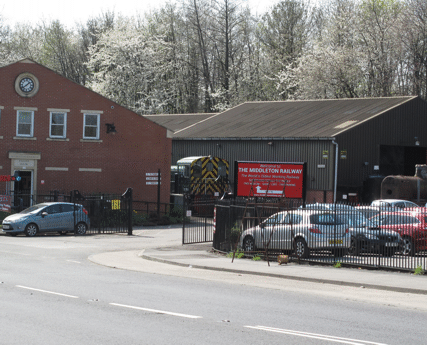
The entrance to our site,
approached from M621 junction 5
From the M621 northbound ...
- (or westbound, for Halifax and Manchester)
- leave at junction 5, for Hunslet, Beeston
- at the top of the slip road there is a dual carriageway
- turn right onto this (Tunstall Road)
- in 100 yards there is a roundabout
- leave this roundabout at the third exit (Moor Road)
- the railway’s Moor Road site is on your right, entrance in 100 yards
|
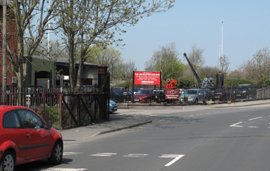
The entrance to our site,
approached from the south along Moor Road
From the M621 southbound ...
- (or eastbound, for Wakefield and Hull)
- junctions 4 & 5 can not be used in this direction
- leave the M621 at junction 6, for Middleton
- at the bottom of the slip road turn left (Belle Isle Road)
- take the next left into Moor Road
- at the mini roundabout go right
- after 300 yards cross the rail tracks in the road
- the railway’s Moor Road site is immediately on your left
|
Arriving by Public Transport
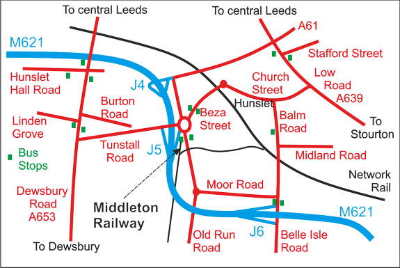
Sketch map showing the location of the Middleton Railway and the roads leading to it
Get directions from the Traveline website ...
- this site mainly identifies places by postcodes, so
- to identify the railway, put in “LS10 2JQ”
- note: the directions it gives may include a walk of up to 20 minutes!
|
From Leeds Station ...
- there is no direct bus route - taking a taxi is recommended
- the route for a taxi is not very direct, either, but
- the journey will be about a couple of miles
- the traveline site may suggest various bus routes:
- some may involve significant walks through the City centre
- others may involve significant walks to the railway
- the sketch map below shows the locations of the City centre bus stops
Back to Leeds Station ...
- our shop staff can call a taxi if you wish
- for bus routes, the sketch map above shows the bus stops near the railway
- the one below also shows the City centre stops for the return journey
|
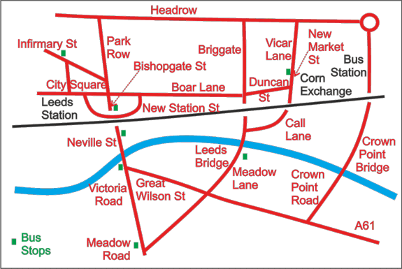
Sketch map of the City Centre, showing the locations of the main bus stops for routes to and from Middleton Railway
Local Public Transport ...
- this site works best with place names, so
- to identify the railway, put in “Middleton Railway”
- note: again, the directions it gives may include a walk of up to 20 minutes!
- alternatively, call MetroLine travel information on 0113 245 7676 (7am-10pm, seven days a week, except Christmas Day, Boxing Day and New Year's Day)
|
More Information
Other pages of our site ...